Learn

What is GIS?
GIS stands for Geographic Information System. GIS is a mapping tool that allows us to link data with specific locations to help with research, monitoring, and analysis. GIS is an important tool that we use at Friends of the Verde River to understand trends, or how things are changing, in the habitat along the river. Because GIS connects data to points on a map using real-world location information, it allows us to connect where things like study sites and plant species are with data about what conditions are like in that location. This helps us better understand larger issues, like how invasive plant species are increasing or decreasing, throughout the entire Verde Watershed.
How do we use GIS at Friends of the Verde River?
We use GIS to pick survey and treatment areas, monitor vegetation changes, and more. GIS allows us to visualize data in map form, helping us to observe trends that might otherwise be hidden in raw data in a spreadsheet or table. We are able to share this data in formats like dashboards and story maps. Check out our recent story map here!
We also use GIS tools in our efforts to collect data, using apps like Collector and Survey 123. We use these tools with our hired restoration crews who monitor and clean up sections of habitat along the Verde, and we also use these tools with our citizen science initiatives.
Instead of using paper forms, our field crews collect data on tablets while they are in the field. When our crews get back from the field to internet access, their data is easily uploaded into the cloud and accessed by Friends staff and shared with our VWRC partners. This quick and easy ability to share data makes it more likely for everyone to make informed decisions and understand what is happening in the watershed.
What is the Importance of GIS?
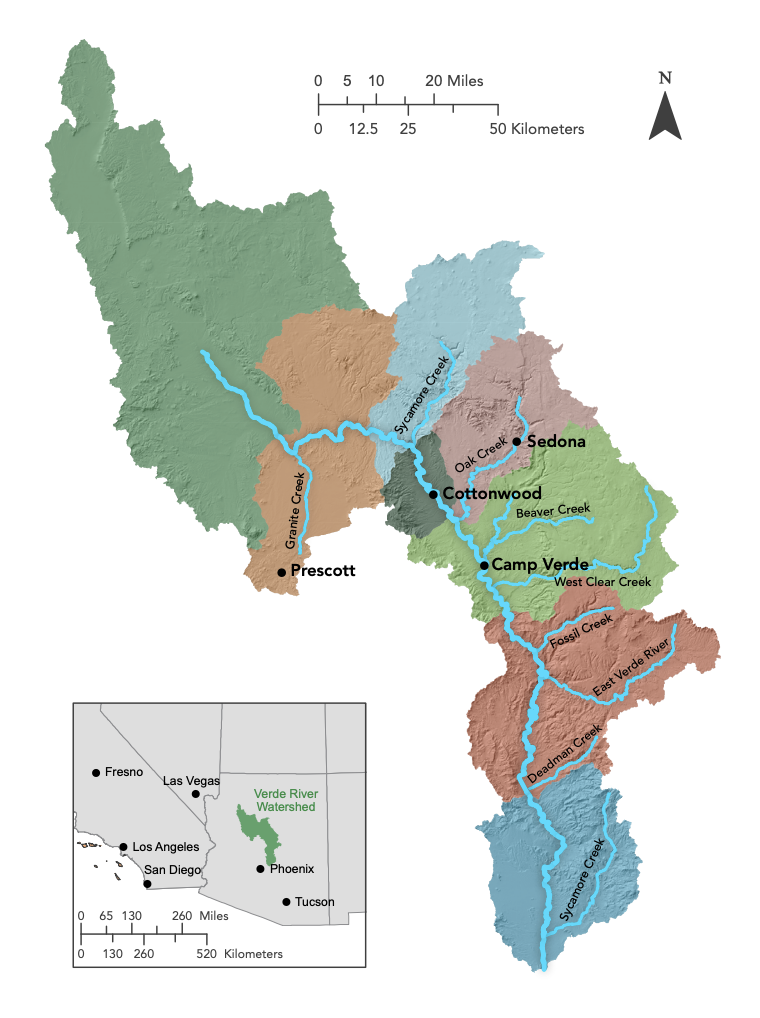
When working from a watershed-wide scale, examining trends across a very large area, it is crucial to be able to communicate issues by showing where they exist on the landscape. GIS allows us to show a visual representation of where our work is happening. Once we know specific information about a location, we can more easily make recommendations for management decisions. By using database information, like Yavapai County’s GIS services, we can quickly learn who the land owner or manager is in certain areas. This helps us target our outreach to areas of high priority.
Everyone loves to find their home or favorite recreation spot on the map! So when we can use GIS maps to show our restoration project is helping an area, it helps people connect our work with a place they know well and care about. In this way, GIS is an important tool for connecting people to our work and encouraging the public to care about watershed restoration.
GIS is a vital resource for decision makers. People in positions of authority make decisions by relying on accurate information. GIS makes this possible by organizing real-world data and making it accessible and usable. We aim to collect data and share it in a way that can inform decision makers to help them make the best choices for the Verde Watershed.
GIS is part of what makes our work possible. Happy GIS Day!


