Toolbox
Any river is really the summation of the whole valley. To think of it as nothing but water is to ignore the greater part.
Hal Borland
The Verde Land & Water Planning Toolbox provides a comprehensive set of tools and strategies for municipal and county level governments to explore as part of their efforts to improve the connection between land use and water management policy and planning. The tools provided in this online database are a menu of options designed to reach community goals for water conservation and demand reduction, and in many cases, also contribute to increased resilience and cost savings that benefit residents as well.
The tools are compiled into a range of search categories that range from the high-level, aspirational planning policies that are typically found in general and comprehensive plans to more specific and targeted planning approaches, such as developer incentives and offsets, and water conservation ordinances. Within each category, case studies provide real-world examples of implementation and feature sample ordinance or policy language that can be tailored and adapted to individual community circumstances.
General & Comprehensive Plans
 Planning policies that influence development or redevelopment can play an important role in water resource management. The most important of these are in general and comprehensive plans, which contain large-scale and long-term community goals and aspirations for future development. In Arizona, the elements of these plans are specified by state statute (A.R.S. §9-461.05 for cities and towns and A.R.S. §11-804 for counties). Plans are in effect for up to ten years, at which point they must be readopted or a new plan adopted to replace it. Plan adoption and amendments must be approved by voters (A.R.S. §9-461.06 and A.R.S. §11-805).
These plans drive public policy and inform regulations for transportation, utilities, land use, water resources, recreation and housing, and provide an opportunity to improve land use and water resource integration. Growing Smarter legislation in 1998 and 2000 attempted to “strengthen the ability of communities to address growth by considering water demand together with land use, growth areas and infrastructure.”
However, guidelines for the Water Resource Element (WRE) are general and do not specify precisely how that linkage is to be made. As a result, few WRE’s identify specific land use or water use goals, or conservation strategies for new development.
To move plan policies to action, communities can develop a separate implementation matrix, with final and interim policy implementation dates and departmental responsibilities, to take the policies through short-term, mid-term and long-term actions to achieve their goals. This allows for consideration of ambitious actions and does not require amending the plan. Even so, it is important to regularly engage the public in a collaborative planning process to ensure community support and avoid unanticipated problems at public hearings.
Improving linkages between the land and water resource elements in the planning process can be achieved through the following:
Development Codes & Standards
 City and county codes of ordinances – including those that affect land use, new development, floodplains, stormwater, and transportation – guide development and reflect the community’s vision for growth. They are the framework that regulates what type of development can occur, from permissible land uses to building density and location. While codes make it easier for a community to implement its vision, they can impede desired types of development if the codes are out of date or are not well aligned with the vision. Conventional codes that zone by use, such as residential, office and retail, rather than mixed-use, restrict development of more walkable neighborhoods with easy access to businesses and services. Codes require development standards, which are design principles, criteria, and specifications to ensure new development is properly planned and built. Codes may also be enacted in response to adopted policies and recommendations.
Development codes can provide opportunities to integrate water conservation objectives and protect local water resources if these are identified as community goals.
For example, “sustainable” development codes generally include low impact development and green infrastructure, protection of sensitive lands, conservation of natural resources, water conservation, and climate resiliency, and generally address urban form and the role of density. The following link provides an example of these frameworks.
A key way to incorporate water conservation and groundwater protection into new development involves design ordinances, codes, and standards that include site planning practices that mimic natural conditions to the extent possible. This includes minimizing impervious surfaces, minimizing alteration of natural vegetation and topography to minimize erosion, implementing landscape design that integrates natural features, and managing stormwater through the use of natural systems (Low Impact Development). Codes can also specify efficient indoor fixtures and technologies, and set prohibitions or restrictions on certain types of water use such as golf courses, or water features like fountains or pools. Development codes can also specify the location and extent of high water use landscaping, such as turf, in new residential and commercial construction.
Improving linkages between land use development codes and standards and water resources can be achieved by incorporating water conservation and management in the following:
Water Conservation Ordinances
City and county ordinances are the critical step in moving policies in comprehensive and general plans and other planning documents into action via law, regulations, and enforceability provisions. Input from stakeholders, particularly the regulated community, is essential to ensure their political acceptability. This may take considerable time, negotiation, and multiple drafts before concerns are sufficiently addressed. Water conservation ordinances are incorporated into various municipal and county code sections with implementation specifications and options defined in development standards. In the case of Sierra Vista, water conservation regulations are primarily housed in a single location in their development code.
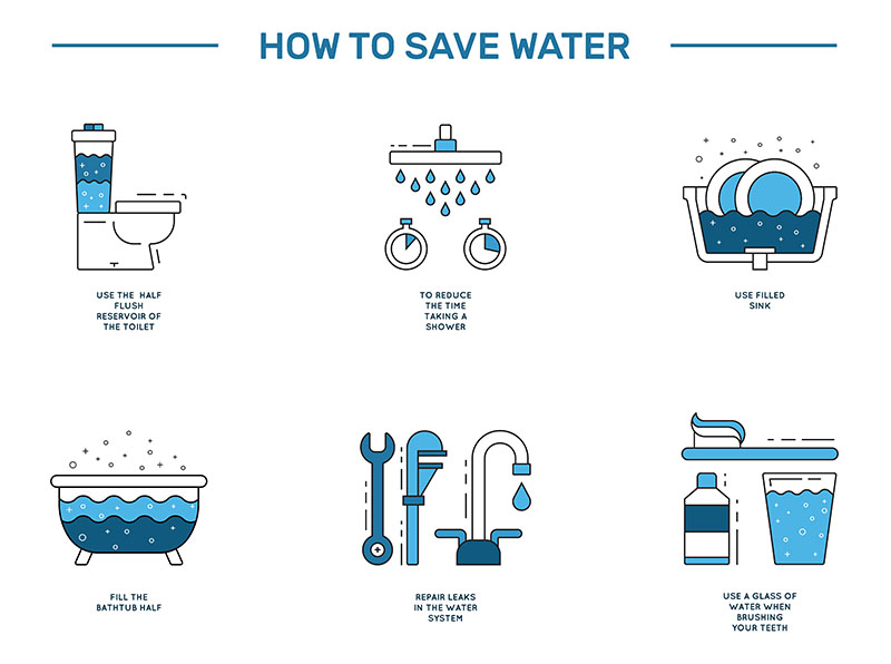
Water conservation ordinances include those that address water use in general, such as water waste, which is widely adopted by Arizona communities; indoor use as described in the Sierra Vista Development Code; and outdoor use. Indoor water use is relatively non-discretionary as compared to outdoor water use – toilet flushing and water used for drinking, bathing and cooking is related to human health and needs and is largely a function of the efficiency of the water using fixture or appliance. Indoor water use is steadily declining as indoor plumbing fixtures become both more efficient and the norm at retail outlets.
Outdoor water use can represent 30 to 60% of household water demand; is primarily discretionary, dependent on landscape preferences, irrigation methods, and the presence of a pool, spa, or water feature; and generally does not require expensive, treated, potable water.
Because of the discretionary, relatively high demand for an expensive resource, integrating outdoor conservation and reuse strategies into land use planning is an excellent opportunity to protect local water resources and save treatment costs by utilities.
This section discusses water conservation ordinances and requirements in two categories:
General Water Conservation including:
Outdoor Water Conservation including:
Zoning Code
 Zoning codes are the primary means by which communities control the use of property by dividing their jurisdictions into zones and prescribing the type of land uses and intensity of development allowed in each zone. Communities use zoning to create a blueprint for future development, which may change over time as property is rezoned. Zoning regulations restrict the rights of owners to use their property for specified uses and densities.
Zoning can be used to protect groundwater and surface water resources by designating the amount and location of open space, the degree of population density, and the location of groundwater recharge areas.
Land use plans can identify lands that contain critical natural resources, such as riparian areas and wildlife corridors that should be preserved, as well as lands suitable for development, including opportunities for infill or for reusing land that was previously developed for a different purpose, and can zone land accordingly. Arizona communities commonly have overlay zoning districts such as historic districts. Few however, have created districts where water conservation or water resource protection is the objective.
New development is driven to specific areas via land use plans and associated zoning use designations – single family residential, industrial, suburban ranch, and others. Ideally, plans and zoning consider access to existing water, wastewater, and transportation infrastructure, which translates to cost savings for taxpayers who inherit infrastructure maintenance costs of new development at the urban fringe. Policies and zoning that encourage infill development help protect open space, prevent sprawl, and can revitalize community centers. Growth in urbanized areas can also be incentivized by a transfer of development rights program to move potential development from rural areas with high natural resource value to more developed areas.
Developers want certainty when contemplating applying to rezone land. Communities can remove uncertainty by conditionally rezoning subject to the developer meeting certain conditions, which would be well defined and could include incorporating water conservation features. Conditional rezoning is not normally done in Arizona, but is authorized by state statute and can be incentivized to encourage its use.
Zoning mechanisms that can be used to advance water conservation and water resource protection include the following:
Subdivision Regulations
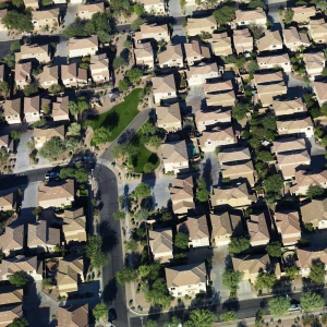
A housing subdivision on the outskirts of the Phoenix metro area in Arizona.
Subdivision (or land division) approval is required when a parcel of raw land is divided into lots for development. Land subdivision is designed to ensure that the lots have adequate streets and utilities, and that the development avoids sensitive lands such as floodplains and steep slopes. Raw land divided for multi-family, commercial, mixed use, industrial, or institutional use, may require both subdivision and then site plan approval.
Subdivision regulations differ from zoning regulations in that they address the quality of the development, such as layout of the site. When properly administered, subdivision regulations can be more useful in achieving planning goals than zoning ordinances. Site development standards set conditions for water use and for how development will happen.
Subdivision control ordinances may give a community its only opportunity to ensure that new neighborhoods are properly designed.
Zoning and subdivision regulations are interconnected; zoning approval often proceeds concurrently with subdivision approval. To be effective, subdivision regulations must be integrated with other local government plans, policies, and ordinances.
The process for a large development typically involves a master development plan (MDP), negotiated between the developer and community planners, that includes general development features and policies as well as population and water use projections. This process can be contentious, but it provides a critical opportunity for a city or town to advance its community goals and discuss water resource and conservation issues. If the development proceeds as a Planned Unit Development (PUD) composed of a single planning district, there is additional flexibility and opportunity to negotiate as the development plans proceed. If there are substantive changes, it can trigger a review of the MDP. Once plans are approved, the process proceeds to subdivision platting, at which time there is little flexibility to modify the development components and no public hearing is required.
Planning and zoning commissions, which review and approve new developments, may not be aware of water conservation features and other innovations that can be incorporated into subdivisions and may need to be informed about new advances in land use planning.
Subdivision regulations can include requirements for:
Understanding Surface Water Rights
The Verde Valley has a rich history of agriculture that continues to this day. Farms and ranches of various sizes dot the landscape. Some who own property in the Verde Valley keep animals, tend gardens or farms, and irrigate lush lawns and large trees. But landowners and potential landowners—especially those looking at irrigated properties—should be aware of some basic laws regarding water rights. Just because a property does irrigate may not mean it has the legal right to do so or that the use will be recognized in the future. For many reasons, there remains uncertainty about the use of surface water from creeks and rivers and even well water on properties throughout Arizona. By understanding some of the basic laws around surface water, you should be able to better evaluate risks and uncertainties associated with a particular water use.
Developer Incentives
 For water-smart planning and development to be successful, the development community and community planners must understand the benefits of integrating water-conserving design.
Water conservation features such as higher density development, low impact development practices to manage stormwater, preservation of native plants, low water use landscaping, graywater and effluent reuse, and others can reduce water and wastewater infrastructure development and landscape maintenance costs. Homebuyers also benefit as low water use translates to lower water bills. However, there are hurdles to water-smart development, including convincing developers that incorporating these features is economically viable and attractive to consumers, and convincing communities that regulatory approaches to development will not cause land developers to locate to another community.
There are increasing examples of water-smart development and partnerships between communities and developers. KB Home is building WaterSense certified communities in the West, and Las Vegas homebuilders have joined with the Southern Nevada Water Authority to build water smart homes. Successful developments like Civano in Arizona, Sterling Ranch in Colorado, and Daybreak in Utah demonstrate that water-smart development techniques are viable, popular among consumers, and save significant amounts of water. Western Resource Advocates’ New House, New Paradigm report has additional information on these strategies.
Providing incentives to developers and homebuilders is a way to promote water-smart development in a non-regulatory way or to offset any additional costs related to water-smart development. Incentives may include allowances for higher density, streamlined approval processes, or reductions in development costs.
Water-conserving development incentives can be in the form of:
Development Offsets

Offset programs allow developers to pay for the costs of mitigating the impacts of new development on water resources when water supplies are strained.
The basic principle of an offset program is that a developer or homebuilder implements, or pays a fee in-lieu of implementing, actions that offset the impacts of their proposed project on water resources.
Offset programs are often implemented when there are water supply shortages or concerns about meeting future growth with currently available supplies.
To address concerns that conservation by existing users may fuel growth, the program must be carefully constructed so it is clear that new development is paying its way, which can be done by having an offset ratio that exceeds a simple one to one exchange. An offset program can take a number of forms, including water conservation, groundwater recharge, and wastewater management, though most programs focus on demand management. Programs tend to evolve over time as communities adjust to changes in where water savings can be realized and in program implementation method.
A water demand offset policy should have comprehensive requirements with sound methodologies for estimating the water demands of new development, and for calculating credits resulting from the savings of water efficiency measures. An offset ratio greater than 1:1 helps ensure that sufficient savings are achieved and accounts for projection error. However, large ratios may make offsets difficult to realize over time as savings potential is reduced. It is also important to ensure that the water efficiency measures are permanent.
While offset programs typically involve residential and commercial development, they can be designed to address other water uses such as new agricultural use. Areas of severe depletion can be targeted with specific offset requirements in order to manage groundwater resources. This involves ongoing groundwater monitoring to assess water resource conditions.
Development offset programs are adopted by ordinance and require a mechanism to implement the offset. Administrative aspects, including monitoring and accurate measurement of savings, are essential. The Alliance for Water Efficiency’s (AWE) report “Water Offset Policies for Water Neutral Growth” researched 13 communities and found that, while effective, there is need for a clear water savings methodology. To improve use of offset strategies, AWE is developing a model ordinance template, part of the Net Blue initiative to advance water neutral growth. While some offset programs require the developer to implement the offset (e.g. replace inefficient fixtures in existing homes), offset mechanisms may include the following:
- Offset Fees or “in-lieu” fees paid by the developer
- Water Conservation Bank
- Water Allocation Policy
In the Verde Valley, the Verde River Exchange is a new pilot program intended to allow groundwater users to voluntarily offset the impact of their use. Administered by Friends of Verde River Greenway, the Exchange resulted from several years of careful planning and collaboration among local stakeholder and community leaders, working with conservation organizations and regional experts. As the first water offset program in Arizona, the Exchange is introducing and testing the concept both in the Verde Valley and through broader conversations in the state.
The Exchange aims to reduce the amount of water removed from the Verde River and its connected groundwater system through a voluntary offset mechanism, modeled after “groundwater mitigation” programs in other states. To create credits, a water user volunteers to reduce their usage through an agreement with Friends of Verde River Greenway and partners. This unused water is then recorded as a “Water Offset Credit” – water that has been returned to the Verde River system. Another groundwater user in the Verde Valley can then purchase the Water Offset Credit to help reduce their water “footprint.” Through this balancing mechanism, total impact of groundwater pumping on the river system is reduced. As of spring 2017, the Exchange program had accomplished two initial demonstration projects, with plans to increase the number of projects and program participants in the coming years.
The Exchange is a completely voluntary, locally administered program. While the program is in its early stages, its initial success may create opportunities to pursue further formalizing or expanding the offset concept in the Verde watershed or other Arizona communities. Moreover, the Exchange serves as an example of a potential voluntary water management tool for local jurisdictions, and an idea to consider and learn from as water management solutions are being developed in the Verde River watershed and beyond.
Water Efficiency Certification
The US EPA WaterSense logo provides labeling information on water efficient products. Photo Credit: US EPA.
Water efficiency certification programs provide an opportunity for homebuilders to market homes and to be recognized as being environmentally responsible. They set a standard by which a builder can be compared to others and, when properly recognized, can be an advertising tool. Certification also provides consumers with a water conservation option when they are making decisions about purchasing a home. Unlike energy efficiency rating systems that have been in place for many years, water efficiency rating programs are relatively new, with a national level program under development.
Certification programs are voluntary and may add a modest amount to the price of a new home, although savings in energy and water costs would offset the initial investment. The LEED (Leadership in Energy and Environmental Design) efficiency rating and certification system is the most widely used system and includes energy, water, and other green building standards. Certifying interior water use efficiency is more easily done as efficient plumbing fixtures and appliances are readily identified, for example by the EPA WaterSense Program. Exterior water use efficiency certification is somewhat less straightforward given the wide variation in landscape design, consumer preference, and climate considerations. However, there is general agreement about what constitutes an efficient landscape; the hallmark of water efficient landscapes are the Xeriscape principles, including turf and pool limits, efficiently irrigated landscapes, use of native and drought tolerant plants, and incorporation of rainwater harvesting.
A national residential water efficiency rating system, the “Water Efficiency Rating (WER) Index,” is under development. By providing a mechanism to score the water efficiency of a house, it could provide the basis for a voluntary water efficiency certification program. The index is similar to energy efficiency standards that are used to verify energy performance by the EPA Energy Star Program, by the mortgage industry, and for federal tax incentives. The index could be an opportunity for utility incentives, dependent on how highly the home scored.
Providing a water efficiency score would allow homebuyers to know how efficiently water is used in homes that they are considering buying, and would provide homebuilders with a competitive tool they can use to market homes.
Several certification programs exist that can be adopted or modified to meet local conditions. Water conservation certification can be part of a developer incentive program where building water-smart homes can result in an expedited approval process and discounted development fees.
Certification programs include:
Stormwater Management
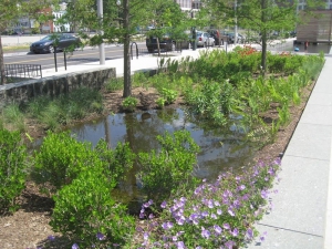
A rain garden in Tucson, Arizona that captures stormwater runoff to support native plant landscaping. Photo Credit: US EPA.
Stormwater management involves addressing complex and challenging human health and ecosystem protection goals. There is growing interest by communities in changing the way stormwater is managed – away from the historic approach of conveying runoff to downstream points as rapidly as possible and toward other approaches such as low impact development (LID) design that retains and uses runoff as close as possible to its source. Traditional stormwater site development conveys surface runoff quickly to a central point, such as a constructed channel or detention basin. Because there are no natural features to slow flow, this results in an increase in runoff volume and peak discharge, while LID reduces the peak discharge rate and runoff volume.
Among the multiple benefits to managing stormwater using LID compared to conventional management approaches are that it saves money for developers and local governments, enhances the local environment, improves community livability by supporting trees that make streets more walkable, and provides recreational opportunities.
“Green Streets” programs, which are generally components of transportation planning, are an example of managing stormwater to enhance community livability.
Stormwater programs are designed to reduce non-point source pollution discharge to rivers and washes to meet federal and state water quality regulations, including Combined Sewer Overflows (CSOs), National Pollutant Discharge Elimination System (NPDES), Stormwater Phase II permits, Total Maximum Daily Load (TMDL) permits, and Nonpoint Source Program requirements. This is typically done by directing runoff to on-site basins. Conventional management typically disrupts the local hydrologic regime, requires construction of expensive stormwater infrastructure, and may not adequately address water quality issues. LID can also be used to address many water quality regulations, using a variety of features including bioretention basins where waters carrying pollutants and sediments are allowed to infiltrate, and water retained on site can be used for landscape irrigation.
Planners and permitting agencies can revise zoning and subdivision regulations to advance more cost-effective and environmentally sound stormwater control at developments by incorporating LID standards, which can provide cost-savings for developers. According to the EPA, “case studies and pilot programs show at least a 25 to 30% reduction in costs associated with site development, stormwater fees, and maintenance for residential developments that use LID techniques.”
Stormwater management approaches include the following:
Drought Planning & Management
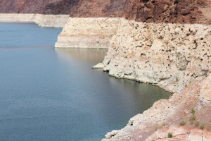
Prolonged drought in the American West has led to dropping water levels in major reservoirs such as Lake Mead.
Land use decisions affect a community’s vulnerability to drought.
In general, land use patterns that maintain the integrity of watersheds and natural recharge, and promote a smaller paved footprint result in greater drought resiliency. This is because water resources are protected and runoff is reduced as rainwater remains in-place where it can be used within the community.
Zoning ordinances, land development standards, and general and comprehensive plans that support compact development, higher densities, water reuse, Xeriscape, and irrigation efficiency make communities better adapted to drought. In large part this occurs because there is less landscape to maintain, water is used efficiently, and more land is kept in natural open space. Drought resilient development puts less strain on water systems by reducing water demand as well as peak demand during summer months.
In Arizona, drought planning is typically done in the context of state-mandated drought response plans rather than in the context of reducing long-term drought vulnerability. The response is implementation of increasingly stringent water use restrictions at different drought stages. Involving land use planning in water shortage contingency planning conducted by water suppliers can identify opportunities to avoid or mitigate drought response at the onset.
Resiliency to drought can be implemented through the following:
Evaluating Surface Water Rights Claims
Before buying property in the Verde Valley that may have surface water use, it is important to learn about the details of that property’s water right Filings and supporting documentation.


