Toolbox
Any river is really the summation of the whole valley. To think of it as nothing but water is to ignore the greater part.
Hal Borland
The highest percentage of land in the Verde River basin is under federal management, and these public lands play a significant role in sustaining the watershed values and flows in the Verde River. Federal land use decision making has a substantial impact on watershed health, with management activities ranging from forest health restoration efforts to recreational activities and amenity development. Federal land acquisition and disposition – including exchanges – can also have an impact on land management and watershed values, even though such transactions have been relatively limited in the Verde River watershed. The Verde Land & Water Planning Toolbox would not be complete without consideration of the impact of management decisions related to federal lands on the Verde River.
There are a number of federal land management entities responsible for managing land and protecting public resources in the Verde River watershed. A description of these federal entities can be found here, along with information about the lands managed and the responsibilities of each agency.
Federal land management priorities that can affect watershed health are developed through a range of processes that are open to participation and comment by adjacent and nearby communities and the interested public. These planning processes and initiatives, as well as opportunities for community and public input, are described here.
Federal Lands in the Verde River Watershed

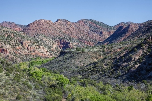
Sycamore Canyon Wilderness in central Arizona.
The most significant land owner in the Verde River watershed is the American people – federal public lands make up 62% of the total land area in the watershed. The majority of federal public lands in the Verde watershed are U.S. Forest Service lands, managed under the U.S. Department of Agriculture. The Prescott National Forest encompasses 1.25 million acres, largely along the southern area of the upper and middle reaches of the watershed, and on the northern end of the watershed lies the 1.8 million-acre Coconino National Forest. The lower reach of the Verde River watershed flows through the Tonto National Forest to the south. These are three of the six National Forests located in Arizona. The management of these lands for multiple use, including recreation, grazing, timber production, and conservation, plays an important role in sustaining important watershed services for the Verde River.
The National Park Service manages a number of National Monuments in the Verde River watershed that protect some of the best archaeological resources of the ancient Sinagua culture that lived in the Verde watershed over 1,000 years ago. Tuzigoot National Monument features an ancient Sinagua pueblo hilltop dwelling located near the Verde River and an important adjacent wetland, Tavasci Marsh. Montuzuma Castle National Monument protects a remarkable Sinagua cliff dwelling, and Montezuma Well National Monument protects ancient ruins and an irrigation ditch dating back to the earliest known human settlements in the region.
A number of other federal agencies operate within the Verde River watershed, and while these agencies do not manage public land units, they provide other services that range from wildlife protection and water resource management, to geological and hydrological data collection and research studies.
More information about the services provided by federal land and natural resource management agencies in the Verde River watershed can be found at the links below:
Federal Land Management Toolbox

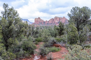
Public lands within Coconino National Forest.
Most federal land management agencies have multiple-use missions that encompass a great number of priorities. Among these priorities are the protection of certain key watershed functions such as maintaining healthy riparian zones and upland forest habitats; sustaining flows of high quality water at a quantity that supports community, economic and environmental needs; and protecting the seeps, springs, and aquifers that feed those watersheds.
This section of the Verde Land & Water Planning Toolbox, therefore, contains less in terms of explicit tools intended for adoption and implementation by federal land managers, and instead focuses on methods for successful civic engagement by local communities and residents in federal agency processes. Through greater involvement in these processes, community leaders and interested citizens can support continued agency actions to maintain and improve watershed health. Morever, community and citizen engagement can ensure well-coordinated approaches to addressing watershed health challenges between federal land managers and local jurisdictions.
Given that the majority of federal public lands within the Verde River watershed are managed by the U.S. Forest Service (USFS), specifically the Prescott and Coconino National Forests, this Toolbox is oriented primarily to USFS planning efforts and collaborative initiatives. Management within National Forest units is driven largely by Land and Resource Management Plans, which are detailed plans that identify needs, goals and objectives for forest management and provide guidance for management actions to reach those goals. Public involvement in the development of Land and Resource Management Plans is solicited and regarded as essential by the agency.
Another significant federal land management decision with serious potential consequences for land use planning and watershed health is the acquisition and disposal of federal public lands. Authority to acquire or dispose of federal lands varies among the agencies. Lands that are prioritized for acquisition by federal land managers are typically those lands that could benefit from federal management, and most often include private in-holdings surrounded by existing federal land units. When considering lands for disposal, federal agencies identify lands that either no longer meet a compelling federal purpose or whose value might be best utilized under other ownership.
Other federal land management agencies’ activities that relate to land use planning and watershed protection include a host of collaborative initiatives. These efforts may be driven by the federal agency to advance land management priorities, or may be initiated by state leaders or local communities to address specific issues and opportunities. For example, the restoration of forest health has emerged as a significant challenge in the long-term protection of watershed resources. The catastrophic wildfires of the past few decades – resulting from prolonged drought, expansion of the range of pests, and the accumulation of brushy, small-diameter thickets of trees and other fuels in forests – have had significant impacts on sedimentation and water quality degradation in Arizona and throughout the West. Areas within the Verde River watershed are encompassed by the Four Forest Restoration Initiative (4FRI), which is a landscape-scale, cross jurisdictional, public-private partnership working to restore forest health in the watersheds of the Kaibab, Coconino, Apache-Sitgreaves and Tonto National Forests. A range of other collaborative initiatives in the Verde River watershed also present opportunities for promoting and protecting long-term watershed health and function, and provide avenues for local community engagement.
The Toolbox focus for this category centers on three main topics: land and resource management planning within federal agencies; land acquisition and disposal priorities at the federal level; and place-based collaborative initiatives.


